For the first time since I started writing this blog, I got an offer to do a guest post. So here we are! Minda is a recent addition to the UCR MFA program, and her first post is about moving with a bike. She has some great info, especially if you're dealing with a shipping service to move your baby. I'll let her introduce herself:
Hi. I’m Minda.
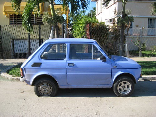
I recently left my gig in sales to get my MFA at UC Riverside. As a sales rep I covered a large territory, first from Santa Barbara to San Diego and all of the Inland Empire and then after a promotion and a move to Denver, half of the state of Colorado. I was averaging 500 miles per week behind the wheel! Fortunately, I was provided a company car and my gas and insurance were both covered. Unfortunately, when I left my job, that meant also leaving the car behind too. After crunching the numbers over and over I came to the conclusion that I would be better off financially during grad school if I did not wipe out my savings to buy a car. So, for the first time since I turned 16, I’m going carless. Please join me in my journey as I learn how to navigate Riverside on two wheels and public trans. I’m looking forward to sharing with you what I learn along the way and any tips you can share with me will be much appreciated :).
(J: And here's her first post. I'm bad at segues.)
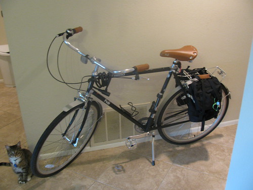
Ok, so I totally brought this headache upon myself. In March, I received a quite nice gift card from my company for being the top sales rep in the region last year. At the time, I knew there was a move in my future, but I had priced out PODS type moving options and figured I would throw everything in my small one bedroom apartment into a POD with plenty of room for a bike too. This way, I could enjoy riding my bike around Denver all summer. I bought a cutsie Retrospec Ladies’ Sidd 7:
Flash forward a couple of months later. I’m ready to throw some money down to reserve a POD and the prices have TRIPLED! Waaaaaay out of my price range. It quickly became apparent that the cheapest way to do this move would be to get rid of or sell as much as possible and replace what I needed on the other end. That left one issue though: my bike. I had just bought my bike, so I really didn’t want to sell it for half price and have to buy another bike at full price once in Riverside. So what were my options?
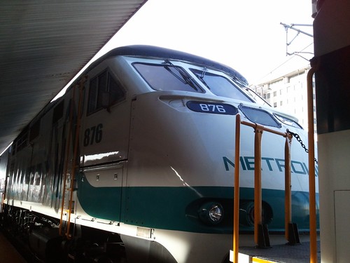
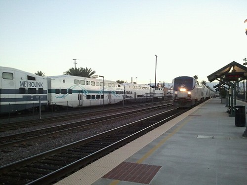
Amtrak
Amtrak is probably one of the lesser known options. If you’re taking Amtrak for your move, then you’ll pay $15 for the bike box and another $10-20 to carry your bike on-board. If you just want to ship your bike via Amtrak, you can call to get a quote for Amtrak Express, which you will tack another $15 on for the bike box. The boxes, I hear, I very large, so typically you only need to take the pedals off your bike to fit it in the box. This is one of the most affordable ways to ship your bike if there’s an Amtrak station convenient to you on both ends.
While there is an Amtrak station in Denver, the closest (J: staffed) one to Riverside is in Fullerton. I wasn’t exactly sure how to get my bike from Fullerton to Riverside (and I wasn’t sure how long I would need to leave my bike at the station since I didn’t have a place picked out in Riverside yet) and just simply was not up for one more logistical problem to solve. (J: The Fullerton Amtrak is also the Fullerton Metrolink, so if you want to ship your bike there, you can simply take the 91 line back to Riverside with it. They'll hold it up to 3 days.)
Bike Rack
Since a friend and I would be road tripping to Cali another friend suggested I buy a bike rack and then Craig’s List it at the end of my road trip. This seemed like a super affordable option. I’ve never used a bike rack (my company car was a minivan, so transporting large things was not an issue), so I had some concerns about whether or not the rack would scuff up the trunk of the rental car over however many miles we would be driving. I was also concerned about not installing the rack correctly and causing damage to my bike, I was concerned about causing damage to the rental car any time I took my bike on and off the trunk, I was worried about my bike getting stolen and I was worried about how it would fare in the parking garage during the Vegas leg of our trip. Just a lot of worrying! I was also having a difficult time finding a Saris Solo rack in town and didn’t really have time to order one in. I also had the challenge of not knowing what car the rental company would give me. There just seemed to be a lot of variables involved. But still a worthwhile option for someone else to look into.
Shipping
Ultimately, I decided to ship my bike, which was the mostly costly option, but was not as costly as I was led to believe it would be and it was also the option that I had to worry the least about, especially since I was shipping all of my other stuff and having it held at the local FedEx anyhow (it’s cheaper to ship from a FedEx to a FedEx and most FedEx locations will hold your items for 5-days).
My local bike shop boxed my bike for $50. You can Google how to do it yourself if you’re handy like that, but I’m a biking newbie, so I decided to let the experts do their thing. My bike shop told me shipping can be tough on your bike, so you really want it packaged well. The bike shop that reassembled my bike said my bike was packed great and to definitely ship wit FedEx over UPS as they receive brand new bikes all the time via UPS and the boxes are all torn up or upside down, just not well cared for. Bike boxing services vary from shop to shop, so definitely call around. Give your shop at least a week’s notice that you’ll be bringing your bike into have it boxed, so they can save the box from a bike they’ve sold that will fit your bike. It’s crucial that they box your bike in the smallest box that will work. I had my bike box measured at one FedEx location and was quoted $46. When I brought it to another FedEx location to ship it that was on my work route, the guy measured an inch more in width and height and the price jumped to $162! Over two inches! Size DOES matter.
There are also discount bike shipping services like shipbikes.com and bikeflights.com. These sites give you discounted shipping prices and track your package for you to make sure it arrives safely. You can also buy a box from their site to box your bike in. It’s really easy to get a quote on the site as well (Ship Bikes quote process is a bit more thorough than Bike Flights). Ultimately, since I didn’t need one of their boxes and had a small discount on my own FedEx account, the few dollars difference wasn’t worth it to me to use either site.
Once my bike arrived in Riverside, I was able to lay the seats down in the back of my rental car and drive it over to Neighborhood Cyclery in Moreno Valley to be assembled (they were the closest bike shop to my new apartment complex). They charged me $60, prices vary, I think fixies are cheaper because you don’t have to deal with the gears and it just depends on how broken down your bike is. It’s a husband and wife ran shop and they were both super kind and friendly over the phone as well as in person. It only took a day until my bike was ready! I caught the bus to their shop and then rode my bike home… in the scorching heat. Welcome to the Inland Empire!
In total, I spent $50 to have my bike boxed, $42 for shipping via FedEx and $60 to have it reassembled for a total of $152. One bike shop in Denver told me it would cost $160 on shipping alone, so I feel like I got off lucky. Getting my bike to Riverside was definitely one of the biggest logistical issues I faced and was ⅓ of my overall shipping costs. Hopefully this breakdown helps anyone that’s not in a position to sell their bike and needs some ideas on how to get it from point A to point B.
Showing posts with label how to. Show all posts
Wednesday, October 29, 2014
Guest Post: Bikes across State Lines
Monday, June 24, 2013
RTA GTFS Data Now Available!
They've apparently been quietly doing it since January of 2012, but I want to applaud RTA for officially making their GTFS (Google Transit Feed Specification) data available to the public, via the GTFS Data Exchange. Open data is really awesome. For those of you who know why open data is awesome, you can stop reading. For the rest of you, a basic primer.
So in this context, a GTFS feed contains the stop, route, and schedule data needed for a transit agency to get on Google Transit. Because Google is the all-powerful data-sucking beast that it is, and because they're really the first people to try to integrate multiple transit agencies' data on a massive scale, it's become a de facto standard for electronically publishing transit information. RTA has obviously had a GTFS feed for a while, since they've been on Google Transit since 2009. To my knowledge, however, while the feed URL was easily discovered with a little creative Googling, the data was not officially publicly available. That meant that the only people who could incorporate it were Google-- and that the vast ecosystem of transit app developers using public GTFS data couldn't incorporate RTA's information as well. This includes not only transit apps like HopStop, but also things like WalkScore, which incorporates transit information and travel times, and AutNo, which allows you to search for apartments within transit commute distance of your work.
Now, with publicly-available data, those tools can integrate RTA's transit schedules in order to give people a better idea as to what their transportation options are-- especially when looking for new housing choices.
What I'd love to see next is the integration of real-time arrival data (which, unbeknownst to many, RTA does have) into the GTFS feed, so instead of a trip plan based on schedules, Google Maps could give you a routing based on which buses were on time, which were late, etc. You might find that a connection that you should, on paper, just miss is actually running a few minutes behind, saving you a long wait, or that, because your bus is late, taking another route might get you there faster. Transit aficionados like myself already know that sort of information, but it'd be cool to make it available to anyone via their smartphones.
Still, though, kudos on the open data, RTA.
Labels:
google transit,
how to,
riverside transit agency,
RTA
Thursday, November 17, 2011
The Transportation Toolbox
I alluded to this post in my earlier Declaration of Independence- from the car, that is. I want to talk about the versatility of the automobile, and the choices people make about transportation often without thinking about them. I want to do this by looking at what a typical auto addict's transportation toolbox, and how it compares to a more balanced one. (Spoiler alert: I'm going to use mine for the "more balanced" column.)
Auto Addict's Transportation Toolbox:

Automobile.
Used for: The vast majority of trips, from the corner store to the daily commute to the occasional cross-country road trip.

Aircraft.
Used for: Moving people for most long-distance trips, generally around a thousand km and up.
Not a lot of diversity here. Now, granted, a lot of people will engage in a walk from time to time, and there are quite a few recreational hikers and cyclists out there... but, for pure transportation, this is roughly what many Americans' lives look like, especially in suburbia- and especially for what used to be called "the middle class." The design of many tract developments especially almost necessitates a toolkit that looks like this, as it often walls people off from walking, cycling and taking transit. Furthermore, for long-distance transportation, many are entirely unaware of our national rail system and (despite encouraging changes in the northeast and in Chicagoland) disinclined to use long-distance bus service.
Let's now take a look at what my transportation toolkit looks like. Now, I'm not saying I'm perfect, but it should be clear that an awareness of one's transportation options allows a better matching between the job at hand and the tool used to do it.
Car-free Transportation Toolbox:

Walking.
Used for: A small number of very short trips, often with company. Honestly, I don't walk too much, but I do on occasion. As I've mentioned, we have a fairly nice shopping centre within five minutes' walk of our apartment, and so sometimes the wife and I will walk there for shopping or a nice dinner.

Bicycling.
Used for: Most trips within a 10 mile radius that I take alone, including moderate cargo hauling. My bike is my go-to transportation tool, and serves the majority of trips I take. You'd also be amazed at the amount of cargo I can haul on the back, with nothing more than panniers and a rear rack. (I'm drooling over the amazingly versatile Burley Travoy trailer, but haven't plunked down the money yet.) Sadly, my wife is difficult to coax on to the back of a bicycle, so it's rare that we pedal places together.

Local Bus.
Used for: A lot of around-town trips, especially during inclement weather, as well as some longer-distance trips that would be difficult to manage on a bicycle. I also used the RTA to haul food for 80 Occupiers downtown earlier, so it's occasionally useful for certain specialized types of cargo. I can also, occasionally, manage to get Dani on to a bus, so we've been known to go out together via transit.

Commuter Rail.
Used for: Pretty much every trip I make to LA or Orange County (though I sometimes use the bus to the OC). Also occasionally the first step in longer-distance rail trips, leaving from LA Union.

Scooter.
Used for: Most trips my wife makes, along with a lot of trips that the two of us makes. It will haul the both of us, and not a whole lot more, so it's not generally used for more than light shopping.

Zipcar.
Used for: Shopping trips, mostly. It's also a great backup when one of us has the scooter and the other one *has* to get somewhere quickly, or when we were dealing with car breakdowns.

Long-distance Rail.
Used for: Any long-distance trip that it makes sense for, including my 30-day 25-state 4-province Amtrak trip. Travel by train is my favourite way to travel- especially if I can afford sleeper.

Long-distance bus.
Used for: Trips where the train can't hack it. Sometimes, I use Greyhound as a supplement to Metrolink and other intra-regional services. Other times, it's used for long highway trips. One must be careful when trying to take the Hound to Vegas.

Aircraft.
Used for: Long-distance domestic trips where time is a factor, as well as international trips (which I haven't taken enough of...).
Once you get away from the car-centric paradigm of transportation, a whole range of transport options opens up to you- and it's important, for all of the reasons that readers of this blog already know, that we restore balance to our transportation system.
NOTE: The photos of the car, ZipCar, airplane, Greyhound bus, and hiking boots are not mine. They are used under Creative Commons licensing, and the photographers are credited in the alt text.
Wednesday, November 9, 2011
How do we think about multi-modal transportation?
The Atlantic has a great piece on Missouri's first-in-the-nation "diverging diamond" interchange, where a livable streets advocate (Charles Marohn) contrasts his interpretation of a walk through the interchange with that of the engineer promoting it. In a larger sense, though, Marohn asks us to think about how we integrate non-auto modes into our transportation system.
Marohn alleges in the video (around 7:00 or so) that the way that traffic engineers think about non-auto mobility is flawed. He says that the design is, first and foremost, designed to meet "the standard engineering parameter of being able to move cars very quickly through here," and only after meeting that criteria are any alternative modes considered. He concedes that the design accommodates pedestrians and cyclists better than some intersections, but that it still demonstrates an overwhelming preference for automobiles over other modes.
If we are really serious about shifting away from the dominance of the car, we need to think about designing transportation systems to accommodate all modes equally, rather than designing for cars first and leaving everyone else as an afterthought.
Sunday, October 23, 2011
Grids, Permeability, and Cycling
I mentioned in a few recent posts that grids are pretty much the ideal network design for any mode of transport, assuming high frequencies. (Low-frequency transit networks, from local bus to airline, can often work best in a hub-and-spoke design, but that's a post for another day.) I'd like to mention a related concept now: permeability. Permeability is a measure of how easily one can move through a city. If you can move easily through an area, without a lot of twists and turns, that area is permeable. Most importantly for those of us trying to create a better city, permeability can be different for different modes.
View Larger Map
Take a look at this slice of Riverside, for example. This is Central and Chicago Avenues, in Canyon Crest. If you are in a car heading down Central and you want to continue west towards Riverside Plaza, you need to turn south on Chicago, drive up the hill to Alessandro/Central/Arlington/Chicago*, and turn west again. If you're walking or on a bike, however, you can use one of my favourite bits of cycle infrastructure in the city- a class I bike path that snakes up into the hills, roughly continuing the line of Central Ave. to Fairview, which takes you through to Central on the other side. (You'll have to zoom in on the above map to see it.)
This particular bit of city is more permeable to cyclists and walkers than it is to drivers- and that's a good thing. It means its a bit easier for a cyclist to get around this neighbourhood than it is for a driver to do the same, which should lead more people to cycle or walk. This is also the central insight behind bicycle boulevards, which allow through cycling but block through motor vehicles.
Of course, facilities out here in the 'burbs can also be designed with improved permeability for motorists, at the expense of other modes. Coming back to Canyon Crest, the Towne Centre shopping centre provides an excellent pedestrian experience- once you're inside. On the outside, there are only three dedicated pedestrian entrances, compared to 7 car entrances- and all pedestrian entrances simply dump you out into the parking lot, often on the hood of a parked car. Even though the Towne Centre is in a relatively walkable area, it is significantly more permeable to auto (and, to some extent, bicycle) traffic than pedestrians.
Making our cities more permeable to pedestrian traffic is not terribly difficult, but it requires thinking about mobility in different ways. There is, for example, no reason for a development to wall itself off entirely from the arterial road it sits on. Adding pedestrian paths (or, for the paranoid, gates) at the end of culs-de-sac would allow residents to choose to walk, rather than being discouraged by a roundabout process for exiting their subdivision. Perhaps some roads could receive a bicycle boulevard-style treatment, becoming closed to through car traffic. (Best of all, those sorts of changes are often clamored for by folks looking to calm neighbourhood traffic.) Small- and cheap!- changes in road design could easily make active transportation the obvious choice for a huge proportion of trips, without disturbing the flow of arterial traffic.
Tuesday, February 22, 2011
Driving for fun!
I've mentioned before that I don't have a problem with people driving for recreational purposes, if we can just make all their other day-to-day trips on better, greener transport. I can freely acknowledge the allure of the automobile- the ability for you, the driver, to have all of the abilities of a powerful machine right at your fingertips, to be used as you see fit.
Let me tell you, though, that I've never had so much fun driving anything as I did over the weekend at Corona's Pole Position Raceway. The proprietors have turned a warehouse into an indoor go-kart raceway- and these are not the go-karts that you've raced about at the local putt-putt centre. They maintain a fleet of electric 20hp karts with a top speed of 45mph. The electric motors mean they're both green AND fantastically powerful at every speed. The way the track is laid out, there's also really nothing for you to slam into- even the track barriers give way nicely, so you can drive these things as fast and as wild as you like.
The good news, alt-transport peoples, is that this is one of the many things that you can do in Riverside without a car! The raceway is a mere block from Magnolia/6th St. and Promenade in Corona, making it a short walk from RTA 1 and Corona Cruiser Blue. From Riverside or Corona, take either of these routes to Magnolia/6th and walk north one block. From elsewhere, take Metrolink to North Main-Corona and catch Corona Cruiser Blue to Magnolia/6th. Also, text "EK20" to 368266 to get a buy-one get-one coupon, giving you 2 races for $20. Satisfy your need for speed without involving a freeway.
Disclaimer: I have not received any compensation from Pole Position, but I did have a really good time there Sunday.
Monday, December 20, 2010
Car-Sharing: How it works, why it's awesome
I've mentioned the wonders of ZipCar car sharing a few times in this space, but the idea is still one of the most potent conversation-starters I have when talking about cars and transit. A lot of people want to know just what car-sharing is, how it works, and whether or not it's right for them. So here's a brief on how car-sharing works, where you can find it, what it costs and why it's a great complement to your bike and transit ways.
Essentially, car-sharing is a way for many people to share an automobile. Simpler forms include a few roommates or neighbours pooling funds to purchase and share one vehicle, but most of the time we're talking about larger services or cooperatives who make their membership available to the general public, subject to a fee and usually a check of their driving record. In California, there are basically three organizations that provide such services: ZipCar, the 800lb gorilla of car-sharing worldwide; CityCarShare, a cooperative with cars in San Francisco and LAXCarShare, a local company providing cars in Los Angeles. From here on out I'll refer to ZipCar specifically (because that's what we've got here in Riverside), but most large car-share services work similarly. Car-sharing services have fleets of cars parked around cities, often at University campuses or transit stations, that any member can reserve for use by the hour. They generally charge a small annual fee and a flat hourly rate, which includes gasoline and insurance. If you live near a car-share car, it can provide you the convenience of a car parked nearby without the exorbitant cost of owning a car, especially if you don't use your car every day. It's great for transit users who have to make an occasional trip that requires driving, or as a replacement for a seldom-used second car.
To join ZipCar, you fill out an application on their web site (see the referral link in the sidebar) and give them your driver's license and credit card information. After a week or so, you'll get a ZipCard in the mail. This card has an RFID chip in it, similar to LA's TAP card or the proximity access cards at many workplaces. Once you have this card, you link it to your account on their web site and you're ready to start making reservations. You can make reservations over the phone, through the web site (which is smartphone-accessible) or via their iPhone app, in half-hour increments. Once you've reserved your car, you go find the car at the start of your reservation, tap your ZipCard to the reader in the windshield, and the car will unlock. The keys are generally on a cord next to the steering column. During the trip, you lock and unlock the car with your ZipCard on the windshield-mounted reader. When you're done you simply return the car to where you got it, lock it and walk away. If it needs gas, there's a gas card in the car which you can use at most gas stations at no cost to you- and if you can't find a gas station that'll take it, ZipCar will reimburse you.
One great thing about ZipCar is that they're worldwide. They have cars in dozens of cities and college towns across the country, as well as fleets in Canadian cities and in the UK. If you're over 21, you can reserve and use any ZipCar anywhere in the world. (18-year-olds can join, but only on college campuses and are limited to the cars available on that campus.) On vacation this spring I was able to quickly pick up a ZipCar in San Francisco for a time-sensitive situation that Muni couldn't handle.
So, why am I promoting expanded access to the world of automobility? Because car-sharing is a fantastic addition to a car-free (or car-lite) household. ZipCar finds that 40% of members reduce the number of cars in their household because of access to car-sharing. It can provide that safety net for somebody to be able to get by without owning a car, and therefore allow them to take transit, walk or cycle for the majority of their trips- knowing that, if they ever need to drive, there's a car around the corner. Furthermore, car-sharing reduces carbon emissions and congestion. The per-hour pricing model provides incentives for members to drive less, chain trips together, and only use a car when they *really* need it. And the ability of people to share cars reduces the number of cars on the road- by approximately 25 per ZipCar, according to the company.
So, where is car-sharing available in SoCal? Right now, there are three ZipCars on the UC Riverside campus- the only ones in the Inland Empire. For my OC readers, cars are available at Chapman University and UC Irvine. In LA County, you can find them at CSU Long Beach, the Claremont Colleges, CalTech in Pasadena, at USC, at UCLA, and (according to the ZipCar Facebook page) throughout Hollywood. San Diegans can find ZipCars at UCSD, San Diego State, San Diego University and Point Loma Nazarene University. Local upstart LAXCarShare also has cars throughout Los Angeles and West Hollywood. Note that, although SoCal cars tend to live near universities, you don't have to be affiliated with the university to use them.
At this point, you're probably wondering what it costs. The prices change based on what market you live in, and many larger ZipCar cities have plans with higher annual fees that allow a certain amount of free hours a month. However, here in Riverside, the cost structure is rather simple. If you're UCR-affiliated, there's no application fee and a $35/year/driver annual fee. If you're not, then there is a $25 one-time application fee, and your annual fee is $50/year/driver. Either way, the cost is minimal. As for actually renting a car, the rate is set on a per-car basis throughout the system, but all three cars in Riverside have the same rates. Weekdays cost $8/hr or $66/day, and weekends $9/hr or $72/day.
So that's car-sharing: an alternative to vehicle ownership that allows mostly-alt-transport people to borrow a car on a whim when they need to. If you live near (read: within walking/biking distance) one of the locations listed above, I encourage you to give it a try- and there's no better way to do so than by clicking on my referral link in this blog's right sidebar. For more information, browse ZipCar's helpful web site.
Wednesday, September 8, 2010
Transit Resources
I've posted a number of How-To posts on this blog before, with information on everything from bus trips to the beach to RTA's fare policies. However, I've never collected those in a single location before, and I'm going to try and do that now. Up top at the right hand side, you'll see a link to "Resources". Any posts that describe something that transit riders ought to know are going to be permanently linked there.
Sunday, August 1, 2010
Summer Transit HOWTO: Museums, Zoos and Other Attractions
The third and final part of my Summer Transit HOWTO series will cover museums, zoos and other attractions in the southland. You can also find and read part 1- amusement parks and part 2- beaches and the outdoors.
As in earlier instalments of this series, all directions are from downtown Riverside.
First off, why not start locally? Downtown Riverside is a veritable treasure trove of museums. The Riverside Metropolitan Museum, the Riverside Art Museum, the UCR-California Museum of Photography, and the Mission Inn Museum all reside right downtown. If you're reading this post after this October, you'll also find the UCR-Culver Centre for the Arts, which will contain the Sweeny Art Gallery among other things. Best of all, you can visit all four of these institutions combined for under $10- the Metropolitan Museum is free ($5 suggested donation), the UCR-CMP is free until September 1st, the Riverside Art Museum is $5, and the Mission Inn Museum is $2 (not including the tour). The Metropolitan Museum, Riverside Art Museum and Mission Inn Museum are all within a block of each other on Mission Inn between Market and Lemon. The UCR-CMP is on the Pedestrian Mall just past University.
Further south in the City is the California Citrus State Historic Park. This working citrus farm celebrates the economic legacy of Riverside and the surrounding region, and is a great place to snag cheap, farm-fresh oranges as well. Best of all, there are no fees for pedestrians or cyclists. Take 1, 10, 12, 13, 14 or 15 to the Galleria at Tyler (1 is usually the quickest, followed by 14) and grab a Hemet-bound 27 to Magnolia & Dufferin, or take the 22 to Van Buren and Trautwein and catch the Riverside-bound 27 in to the same stop. Barring that, the park is only a block or two from the excellent Victoria Avenue bikeway- just take 14th street to Victoria, turn right and keep riding.
The San Bernardino County Museum in Redlands is an excellent institution, with an extensive natural history collection that shows the geological and biological past of the Inland Empire. At only $8, it's a bargain. Take Omni 215 to Mt. Vernon & Centrepoint, then cross the street and grab the Redlands-bound Omni 19 to Redlands & Nevada. Walk north on Nevada to Orange Tree Ln, then west on Orange Tree until you get to the museum. There are also a number of museum remote sites that you can visit- check Google Transit for directions.
For the rock star in you, there's the Fender Museum of Music and the Arts in Corona. The museum is a short walk from the North Main-Corona Metrolink (91 and IE-OC Lines), or you could ride the 1 to Belle & 6th, walk over to Main & 5th and catch either the 3 or the Corona Cruiser Blue Line to the stop adjacent to the Corona Plaza shopping centre, within half a block of the museum.
If you like trains, like I most obviously do, you can visit the Orange Empire Railway Museum in Perris. Wandering around their extensive collection of the golden age of both passenger rail and streetcars- including what's left of the Los Angeles Electric Railway and Pacific Electric fleets- is free, but on weekends, the museum operates some of their equipment. An all-day pass to ride costs $12. To get there, take the 22 to Perris Transit Centre, walk west on 4th street to A, turn left and walk about a mile to the museum. However, if it's a weekend, you have the option of arriving in style- the museum trains run from 11am to 5pm, and you can simply purchase your ticket at the Perris Depot (adjacent to the Transit Centre) and ride the rails to the museum. (I previously wrote about the OERM, and took lots of pictures on my last visit.)
If your tastes run more to the warm and fuzzy, the Santa Ana Zoo may be just the thing. Joseph Prentice, the man who donated the land for the zoo, did so with the stipulation that the City of Santa Ana keep at least 50 monkeys on site at all times. At an adult admission price of $8, that's 16 cents per monkey. Take the Metrolink IE-OC Line to Santa Ana station, then either walk the ~1.2 miles to the zoo (east on Fruit St., then right on Eastwood Ave., left on 4th St., right on Grand, left on 1st and right on Elk) or catch the OCTA 59 on Santa Ana Blvd. (just walk north on the Metrolink platform to the street, then turn left) to Grand & Chestnut, then cross the street and walk east on Chestnut to the zoo.
There are, of course, plentiful museums and attractions in Los Angeles. For all of these, you'll need to ride the Metrolink to Union Station. On weekdays, take the Riverside Line directly there. On weekends, you'll need to ride the IE-OC line to Orange and then the OC line north, or take the Omni 215 to San Bernardino, walk or take the Omni 4 to the San Bernardino Metrolink and ride the San Bernardino line to LA. All directions for the following attractions are given from Union Station.
The Museum of Contemporary Art in downtown Los Angeles features a wide variety of, well, contemporary art. The museum is spread across two sites. The MOCA Grand Center is located at Grand & 3rd, a short walk from the Civic Center station on the Red and Purple Lines. From the station, walk northwest on 1st to Grand, and then southwest on Grand to the museum. For the Geffen Contemporary at MOCA, take the Gold Line towards Soto and get off at Little Tokyo/Arts District. Walk northwest on 1st and turn right at the plaza between the buildings. Adult admission is $10 and is valid at both sites, and admission is two-for-one with your valid transit ticket. (Note- to get from one to the other, just walk the ~6 blocks down 1st street, or take the Metro 30 from Broadway & 1st to San Pedro & 1st.)
The Los Angeles Natural History Museum and the California Science Center are both located in Exposition Park, across from the USC campus. Each have enough science-y goodness to delight any geek or geek in training. Take the Metro Red or Purple Line to 7th/Metro Center and catch theLADOT DASH F from 7th/Flower to Exposition Park. Note that this part of the route is a turnaround loop- to go home, board at the same stop where you were dropped off. Dani and I got stranded in Los Angeles once because we didn't know this. (With the newly-completed Exposition Line, simply transfer to that at 7th/Metro, exiting at either Expo Park/USC or Expo/Vermont.) Show your valid transit ticket for $2 off admission to the Mummies of the World exhibit at the Cal Science Center.
The Los Angeles County Museum of Art and the Page Museum at the La Brea Tar Pits are on opposite sides of a park from each other. Satisfy your curiosity about the art of the past century, or the flora and fauna of the last Ice Age, with one convenient bus trip. Take the Metro Red or Purple Line to Wilshire/Vermont, then catch the Metro 720 or 920 Rapid to Wilshire & Fairfax. Walk back the way you came to get to the Page Museum. LACMA is behind the field of street lights.
Griffith Observatory is an astronomy geek's dream. The site has been a centre for public education about the stars since the turn of last century, and continues to stun visitors after its recent renovation. Unless you're a big, big fan of hiking, this is a weekends-only trip. Take the Metro Red Line to Vermont/Sunset, then grab the LADOT DASH Griffith Park Shuttle, which will take you straight to the observatory. This route is not in Google Transit, so do your own trip planning.
The Huntington Library in San Marino, CA is an art museum and botanical garden of the highest calibre, and has one of the most popular museum free days in the area (1st Thursday, reservations required, August is already sold out). Unfortunately, it isn't terribly easy to get to on transit, but if you feel like 1.5 miles worth of walking, take the Metro Gold Line to Allen and either start walking south on Allen or catch the Pasadena ARTS #10 to Del Mar & Allen, then start walking.
Finally, Los Angeles also has a zoo. Take the Metro Red Line to Universal City, then the Metro 96 to the zoo. Keep your transit ticket- it's good for $3 off the $14 adult admission charge.
Oh, and a special mention to a location that ought to be on here, but isn't- the Getty Center Los Angeles is one of the premiere art museums in the country, if not the world, and it's free. So why not include it in this guide? The transit trip to the Getty is over 5 hours. With Metrolink being Metrolink, by the time you get to the museum, you'd have a whole half an hour there before having to turn around and come back- barely enough time to ride the tram from the entrance gate to the museum grounds. For the curious, it's a ride on the Red line to Universal City, then a trip on the 750 to Ventura/Sepulveda and the 761 south to the museum. DO NOT TRY THIS, unless you have somebody bringing you home. If you want to take transit to the Getty, advocate for the Subway to the Sea- phase one of the Purple Line will bring riders to Wilshire/Westwood, where you could catch the 761. In the meantime, you could snag a ZipCar.
As always, standard disclaimers apply. Plan your trip carefully, and make sure you're not so lost in your outing that you miss the last bus home. RiR is not responsible for bad trip planning.
As in earlier instalments of this series, all directions are from downtown Riverside.
First off, why not start locally? Downtown Riverside is a veritable treasure trove of museums. The Riverside Metropolitan Museum, the Riverside Art Museum, the UCR-California Museum of Photography, and the Mission Inn Museum all reside right downtown. If you're reading this post after this October, you'll also find the UCR-Culver Centre for the Arts, which will contain the Sweeny Art Gallery among other things. Best of all, you can visit all four of these institutions combined for under $10- the Metropolitan Museum is free ($5 suggested donation), the UCR-CMP is free until September 1st, the Riverside Art Museum is $5, and the Mission Inn Museum is $2 (not including the tour). The Metropolitan Museum, Riverside Art Museum and Mission Inn Museum are all within a block of each other on Mission Inn between Market and Lemon. The UCR-CMP is on the Pedestrian Mall just past University.
Further south in the City is the California Citrus State Historic Park. This working citrus farm celebrates the economic legacy of Riverside and the surrounding region, and is a great place to snag cheap, farm-fresh oranges as well. Best of all, there are no fees for pedestrians or cyclists. Take 1, 10, 12, 13, 14 or 15 to the Galleria at Tyler (1 is usually the quickest, followed by 14) and grab a Hemet-bound 27 to Magnolia & Dufferin, or take the 22 to Van Buren and Trautwein and catch the Riverside-bound 27 in to the same stop. Barring that, the park is only a block or two from the excellent Victoria Avenue bikeway- just take 14th street to Victoria, turn right and keep riding.
The San Bernardino County Museum in Redlands is an excellent institution, with an extensive natural history collection that shows the geological and biological past of the Inland Empire. At only $8, it's a bargain. Take Omni 215 to Mt. Vernon & Centrepoint, then cross the street and grab the Redlands-bound Omni 19 to Redlands & Nevada. Walk north on Nevada to Orange Tree Ln, then west on Orange Tree until you get to the museum. There are also a number of museum remote sites that you can visit- check Google Transit for directions.
For the rock star in you, there's the Fender Museum of Music and the Arts in Corona. The museum is a short walk from the North Main-Corona Metrolink (91 and IE-OC Lines), or you could ride the 1 to Belle & 6th, walk over to Main & 5th and catch either the 3 or the Corona Cruiser Blue Line to the stop adjacent to the Corona Plaza shopping centre, within half a block of the museum.
If you like trains, like I most obviously do, you can visit the Orange Empire Railway Museum in Perris. Wandering around their extensive collection of the golden age of both passenger rail and streetcars- including what's left of the Los Angeles Electric Railway and Pacific Electric fleets- is free, but on weekends, the museum operates some of their equipment. An all-day pass to ride costs $12. To get there, take the 22 to Perris Transit Centre, walk west on 4th street to A, turn left and walk about a mile to the museum. However, if it's a weekend, you have the option of arriving in style- the museum trains run from 11am to 5pm, and you can simply purchase your ticket at the Perris Depot (adjacent to the Transit Centre) and ride the rails to the museum. (I previously wrote about the OERM, and took lots of pictures on my last visit.)
If your tastes run more to the warm and fuzzy, the Santa Ana Zoo may be just the thing. Joseph Prentice, the man who donated the land for the zoo, did so with the stipulation that the City of Santa Ana keep at least 50 monkeys on site at all times. At an adult admission price of $8, that's 16 cents per monkey. Take the Metrolink IE-OC Line to Santa Ana station, then either walk the ~1.2 miles to the zoo (east on Fruit St., then right on Eastwood Ave., left on 4th St., right on Grand, left on 1st and right on Elk) or catch the OCTA 59 on Santa Ana Blvd. (just walk north on the Metrolink platform to the street, then turn left) to Grand & Chestnut, then cross the street and walk east on Chestnut to the zoo.
There are, of course, plentiful museums and attractions in Los Angeles. For all of these, you'll need to ride the Metrolink to Union Station. On weekdays, take the Riverside Line directly there. On weekends, you'll need to ride the IE-OC line to Orange and then the OC line north, or take the Omni 215 to San Bernardino, walk or take the Omni 4 to the San Bernardino Metrolink and ride the San Bernardino line to LA. All directions for the following attractions are given from Union Station.
The Museum of Contemporary Art in downtown Los Angeles features a wide variety of, well, contemporary art. The museum is spread across two sites. The MOCA Grand Center is located at Grand & 3rd, a short walk from the Civic Center station on the Red and Purple Lines. From the station, walk northwest on 1st to Grand, and then southwest on Grand to the museum. For the Geffen Contemporary at MOCA, take the Gold Line towards Soto and get off at Little Tokyo/Arts District. Walk northwest on 1st and turn right at the plaza between the buildings. Adult admission is $10 and is valid at both sites, and admission is two-for-one with your valid transit ticket. (Note- to get from one to the other, just walk the ~6 blocks down 1st street, or take the Metro 30 from Broadway & 1st to San Pedro & 1st.)
The Los Angeles Natural History Museum and the California Science Center are both located in Exposition Park, across from the USC campus. Each have enough science-y goodness to delight any geek or geek in training. Take the Metro Red or Purple Line to 7th/Metro Center and catch the
The Los Angeles County Museum of Art and the Page Museum at the La Brea Tar Pits are on opposite sides of a park from each other. Satisfy your curiosity about the art of the past century, or the flora and fauna of the last Ice Age, with one convenient bus trip. Take the Metro Red or Purple Line to Wilshire/Vermont, then catch the Metro 720 or 920 Rapid to Wilshire & Fairfax. Walk back the way you came to get to the Page Museum. LACMA is behind the field of street lights.
Griffith Observatory is an astronomy geek's dream. The site has been a centre for public education about the stars since the turn of last century, and continues to stun visitors after its recent renovation. Unless you're a big, big fan of hiking, this is a weekends-only trip. Take the Metro Red Line to Vermont/Sunset, then grab the LADOT DASH Griffith Park Shuttle, which will take you straight to the observatory. This route is not in Google Transit, so do your own trip planning.
The Huntington Library in San Marino, CA is an art museum and botanical garden of the highest calibre, and has one of the most popular museum free days in the area (1st Thursday, reservations required, August is already sold out). Unfortunately, it isn't terribly easy to get to on transit, but if you feel like 1.5 miles worth of walking, take the Metro Gold Line to Allen and either start walking south on Allen or catch the Pasadena ARTS #10 to Del Mar & Allen, then start walking.
Finally, Los Angeles also has a zoo. Take the Metro Red Line to Universal City, then the Metro 96 to the zoo. Keep your transit ticket- it's good for $3 off the $14 adult admission charge.
Oh, and a special mention to a location that ought to be on here, but isn't- the Getty Center Los Angeles is one of the premiere art museums in the country, if not the world, and it's free. So why not include it in this guide? The transit trip to the Getty is over 5 hours. With Metrolink being Metrolink, by the time you get to the museum, you'd have a whole half an hour there before having to turn around and come back- barely enough time to ride the tram from the entrance gate to the museum grounds. For the curious, it's a ride on the Red line to Universal City, then a trip on the 750 to Ventura/Sepulveda and the 761 south to the museum. DO NOT TRY THIS, unless you have somebody bringing you home. If you want to take transit to the Getty, advocate for the Subway to the Sea- phase one of the Purple Line will bring riders to Wilshire/Westwood, where you could catch the 761. In the meantime, you could snag a ZipCar.
As always, standard disclaimers apply. Plan your trip carefully, and make sure you're not so lost in your outing that you miss the last bus home. RiR is not responsible for bad trip planning.
Thursday, July 29, 2010
Summer Transit HOWTO: Beaches & The Outdoors
Here's part 2 of my Summer Transit HOWTO series. We've already covered Amusement & Water Parks in part 1, but if you're looking for a day trip with a little less artificiality (and a lot less of an admission fee), you've come to the right place. In many cases, the entrance fees you pay at regional and state parks apply only to automobiles, and pedestrians and cyclists are admitted free. In others, you pay a significantly reduced fee. With that in mind, let's take a look at some car-free outdoor recreation activities.
As with last time, all directions are from downtown Riverside.
The Beach!
The simplest way to get to the beach is by taking the beach train. Once a popular specially-chartered service funded by RCTC, Metrolink has integrated the beach train into their regular service. Two trains daily each morning will take you down to either San Clemente or Oceanside along the IE-OC line, and two trains daily each afternoon will return you back to Riverside. The beach stations are both within a block or two of the sand. Even better, on weekends Metrolink offers the Friends and Family Four Pack, which allows a group of up to 4 people to travel all day for just $29, so long as they travel together. It goes without saying that you can ride the regularly-scheduled IE-OC line to San Clemente or Oceanside on weekdays as well, though note that the San Clemente Pier is not served on weekdays- you can catch the OCTA 191 from the San Clemente station to the beach.
Of course, Southern California is flush with beaches, and perhaps neither San Clemente nor Oceanside fit your needs. Newport Beach is accessible on one very, very long bus trip. Take the 216 to the Village at Orange and catch a southbound OCTA 71, which will take you all the way there. Once at the coast, of course, you can catch the OCTA 1, which travels up and down Pacific Coast Highway, giving you the choice of nearly any beach you can think of in Orange County. You can also reach Huntington Beach by taking the train to Buena Park station and riding the OCTA 29 all the way to the end. The best route to Laguna Beach is via the Santa Ana Metrolink, which you can reach on the IE-OC line, and then the OCTA 83 to Laguna Hills Mall and the OCTA 89 to the beach.
If Orange County isn't your style, Venice Beach in Los Angeles is accessible to you as well, as is Santa Monica. For Venice, take the Metrolink to Los Angeles Union Station (on weekends, take the IE-OC south and transfer at Orange for the OC line, or take the Omni 215 to San Bernardino and catch the San Bernardino line) and catch the Metro 733 Rapid from Patsouras Transit Plaza at Union Station. For Santa Monica, catch the Red or Purple line subways from Union Station to Wilshire/Vermont and catch a Metro 720 or 920 Rapid. (Make sure the bus is headed all the way to Santa Monica- this route often short-turns in Westwood.) For Hermosa Beach or Redondo Beach, ride the 91 Line (or IE-OC and OC Lines, with a change in Orange, on the weekend) to Norwalk Metrolink, then take a Norwalk Transit 4 to Norwalk Green Line station. Take the Green Line to Mariposa station, and catch a Metro 232 down PCH to Pier Ave. in Hermosa Beach, or Torrance Blvd. in Redondo Beach. For Long Beach, take the Metrolink to Union Station, followed by a Red or Purple Line subway to 7th/Metro Center and a Blue Line train all the way south to 1st Street. Walk south on Long Beach to Ocean, and then east on Ocean to 1st Pl., where you can find public access to the city's namesake beach.
Outdoors
Riverside is brimming with abundant hiking and cycling facilities. For those who want to start getting in shape, a gentle walk up Mount Rubidoux near downtown is in order. From the downtown terminal, just walk west on University towards the mountain, turn left at Brockton and right at 9th street, and keep walking until you see the park gate on the left. Experienced hikers can also enjoy some of the many more challenging dirt trails that lace the mountain- for one, instead of turning left at the main park entrance, keep walking up 9th street until you see wooden steps in front of you.
For a more challenging hike, with more rewarding views, try hiking to the large C on Box Springs Mountain. The direct trail leaves from Islander Park at the end of Big Springs Rd.- take the 10 to Big Springs & Mt. Vernon and walk west on Big Springs past the municipal pool. The trails begin on the left. Be careful when crossing the railroad tracks.
Trails criss-cross the vast and undeveloped Sycamore Canyon Wilderness Park. One trailhead is available on Central Ave. just east of Canyon Crest Dr.- take the 16 to Central at Canyon Creek Apts. and walk east on Central to the trailhead. Another access point for public transit patrons is available at the end of Barton Rd. in Mission Grove. Take the 1, 14, or 15 to Magnolia and Beatty, and then take the 20 to Alessandro and Barton. Walk north on Barton to the trailhead.
To get better connected to the river in Riverside, try visiting Martha McLean- Anza Narrows Park. Take the 12 east to Jurupa & Grand, then walk east on Jurupa- the park will be on your right. The river bottom is wild and accessible here, and numerous trails cross it. Also, the last time I visited a picnic bench was placed squarely in the river itself, offering a unique dining opportunity. Note: Unlike most parks, this one (and possibly all RivCo parks) charge pedestrians and cyclists for day use. The fee is $2, doesn't apply to entry before 9:00 AM, and can be avoided by taking the Santa Ana River Trail into the park instead.
If you're looking for water, but not the salt variety, Lake Elsinore is always an option. Take the 22 to the Lake Elsinore Outlet Center. If you'd like to go swimming, take the 7 to Graham & Lindsay and walk south on Lindsay to Elm Grove Beach. If you'd rather go boating, take the 8 to Riverside Dr. in front of Lakeside High School and cross the street to Lake Elsinore Marina and RV Resort. Motor boats and jet skis are available to rent.
There is one option for camping in the local area that is somewhat transit-accessible. The Rancho Jurupa campground in Rubidoux is along the Santa Ana river bottom, and is about a mile's hike in from the nearest bus stops. Take 49 to Mission & Crestmore and walk down Crestmore to the park entrance, or take 29 to Limonite and Riverview and walk down Riverview to 46th, then turn left on 46th and walk to the park entrance. Campsites aren't cheap, but they do include full hookups, cable TV and wireless internet. Primitive camping is available according to the park web site, but very little information is available online. You can contact Riverside County Parks at (800) 234-7275.
If you're up for a bit of a hike (2.2 miles), you can also enjoy Lake Perris State Recreation Area, with camping, boating, hiking, swimming, fishing, and basically anything else you can expect to do outdoors (except mountain biking- bicycles are restricted to paved roads only, oddly). Take 1, 14 or 15 to Magnolia and Beatty, then grab the 20 to Moreno Beach & Via del Lago in Moreno Valley. Turn south on Via del Lago and start hiking- RiR suggests you do this early in the day, and bring plenty of water. Pedestrians and cyclists are free at this park, while vehicles are charged $10 each, so you can enjoy the satisfaction of saving $10 and getting exercise while you do it. Boat rentals are also available, though the park advises that boat quotas will be enforced, especially on summer weekends.
Keep in mind
As with the amusement parks, it's easy to lose track of time when you're out having fun. Figure out when the last bus home leaves, and make sure you're on it. RiR is not responsible for bad planning. Also, the usual caveats of outdoor activities apply- plenty of water, plenty of sunscreen, and plenty of not-putting-yourself-in-dangerous-situations-unless-you-know-what-the-hell-you're-doing. Visitors to Riverside County parks may want to know that some of these parks (Anza Narrows at least) charge pedestrians and hikers, even for day use.
Coming up next, part three of the series will highlight museums, zoos and other attractions around the region.
Wednesday, July 28, 2010
Why Don't We Have This?
My readers are most certainly aware of the concept of the universal transit pass- everyone at a given organization or institution gets an all-access transit pass at no cost to them, and the institution pays a deeply discounted rate for said passes. Here in Riverside, college students at UCR, La Sierra, Cal Baptist, and the Riverside and MoVal campuses of RCC get these sorts of passes, as do City of Riverside employees. However, in Riverside, each of these agreements was negotiated separately, the terms of each of them are different, and the contracts have to be renewed individually on a yearly basis. In fact, the names of the various college passes are different: UCR's program is called U-PASS, RCC's GO-PASS, and I'm unsure about which name the other campuses fall under. If you're a large employer in the region who wanted to offer transit benefits to your employees right now, you would have to devote substantial staff time and resources to approaching RTA and developing your own unique agreement with them- something you're probably not likely to do. However, it benefits employers, employees, RTA and the region to develop these sorts of programs- employers and employees both get tax breaks, employers often see lower absenteeism, employees don't have to pay for their transportation, RTA gets a steady source of revenue, and the whole region benefits from better transit services, cleaner air, and fewer cars on the road.
Fortunately, there is a better model. Those who have read Donald Shoup's epic "The High Cost of Free Parking" will know that I'm talking about the Santa Clara Valley Transportation Authority's Eco Pass program in the San Jose area. Organizations purchase passes for all of their employees on an annual basis. The passes are heavily discounted- the most expensive Eco-Pass agreement is $144/employee/year- and they entitle holders to use of every VTA transit service, be it local or express bus or light rail. The agency then provides support to the organization in the form of occasional on-site visits for promotions, personalized trip planning, and guaranteed ride home programs in case of employee or family emergencies. (A guaranteed ride home program already exists in Southern California, as a stand-alone program.)
But wait, there's more! VTA also offers Eco Passes to residential communities of 25 units or more. The most expensive pass plan would amount to a $20/month rent hike. Apartment communities, condos and homeowners' associations are allowed to buy passes for every resident over 5 years of age in their community, and those residents are then given a photo ID pass that entitles them to access to every VTA transit vehicle.
Even better than the benefits that occur directly because of the Eco Pass program are the ways that some cities in Silicon Valley are using these programs. Shoup cites Redwood City and Palo Alto as using the Eco Pass as a way to change the urban form of their communities. Properties that agree to provide Eco Passes to employees or residents gain substantial reductions to their minimum parking requirements, allowing them to build more housing/office space in less space. Compared to the cost of maintaining the parking spaces, the Eco Pass is often significantly cheaper, and it saves the cities from being blighted with yet more surface parking.
The three-tier pricing structure that Eco Pass uses appears to be tied in with how likely employees are to switch to transit: the heavily-served downtown area of San Jose is the most expensive, followed by areas within 1/4 mile of a light rail station (people are more likely to ride the train), and then everywhere else. If we were to set up a similar system in Riverside County, I suggest the following three categories: Downtown Riverside, Riverside/Moreno Valley, and elsewhere in the county. Also, our prices ought to be quite a bit lower than VTA's, considering the difference in service offered. For reference, a general VTA Express monthly pass runs $140, while our equivalent Commuterlink 30-day pass costs $75. If we accept the ratio of these two passes as the appropriate difference in cost for Eco Passes, we come up with the following pricing structure for businesses in the RTA service area. Keep in mind that these are ANNUAL prices, and none of them exceeds the cost of the equivalent 30-day pass:
* I don't think that there are any employers or apartment complexes in the I.E. with over 15,000 employees/residents. I could be wrong, of course.
So RTA, your part is to establish this program, connect it to the existing Guaranteed Ride Home infrastructure, and offer it to employers and residential communities.
City of Riverside, you should provide incentives for developers and companies to sign their properties up with this program when they apply for permits, by reducing the number of parking spaces required, allowing density bonuses, and other no-cost zoning law changes that could really improve the urban form of our city.
How about it?
Fortunately, there is a better model. Those who have read Donald Shoup's epic "The High Cost of Free Parking" will know that I'm talking about the Santa Clara Valley Transportation Authority's Eco Pass program in the San Jose area. Organizations purchase passes for all of their employees on an annual basis. The passes are heavily discounted- the most expensive Eco-Pass agreement is $144/employee/year- and they entitle holders to use of every VTA transit service, be it local or express bus or light rail. The agency then provides support to the organization in the form of occasional on-site visits for promotions, personalized trip planning, and guaranteed ride home programs in case of employee or family emergencies. (A guaranteed ride home program already exists in Southern California, as a stand-alone program.)
But wait, there's more! VTA also offers Eco Passes to residential communities of 25 units or more. The most expensive pass plan would amount to a $20/month rent hike. Apartment communities, condos and homeowners' associations are allowed to buy passes for every resident over 5 years of age in their community, and those residents are then given a photo ID pass that entitles them to access to every VTA transit vehicle.
Even better than the benefits that occur directly because of the Eco Pass program are the ways that some cities in Silicon Valley are using these programs. Shoup cites Redwood City and Palo Alto as using the Eco Pass as a way to change the urban form of their communities. Properties that agree to provide Eco Passes to employees or residents gain substantial reductions to their minimum parking requirements, allowing them to build more housing/office space in less space. Compared to the cost of maintaining the parking spaces, the Eco Pass is often significantly cheaper, and it saves the cities from being blighted with yet more surface parking.
The three-tier pricing structure that Eco Pass uses appears to be tied in with how likely employees are to switch to transit: the heavily-served downtown area of San Jose is the most expensive, followed by areas within 1/4 mile of a light rail station (people are more likely to ride the train), and then everywhere else. If we were to set up a similar system in Riverside County, I suggest the following three categories: Downtown Riverside, Riverside/Moreno Valley, and elsewhere in the county. Also, our prices ought to be quite a bit lower than VTA's, considering the difference in service offered. For reference, a general VTA Express monthly pass runs $140, while our equivalent Commuterlink 30-day pass costs $75. If we accept the ratio of these two passes as the appropriate difference in cost for Eco Passes, we come up with the following pricing structure for businesses in the RTA service area. Keep in mind that these are ANNUAL prices, and none of them exceeds the cost of the equivalent 30-day pass:
RTA Business | 1-99 | 100-2,999 | 3,000+* |
---|---|---|---|
Downtown Riv. | 74.88 | 56.16 | 37.44 |
Riv/MoVal | 56.16 | 37.44 | 18.72 |
Other | 37.44 | 18.72 | 9.36 |
RTA Residential | 1-99 | 100-2,999 | 3,000+* |
---|---|---|---|
Downtown Riv. | 62.40 | 46.80 | 31.20 |
Riv/MoVal | 46.80 | 31.20 | 15.60 |
Other | 31.20 | 15.60 | 7.80 |
* I don't think that there are any employers or apartment complexes in the I.E. with over 15,000 employees/residents. I could be wrong, of course.
So RTA, your part is to establish this program, connect it to the existing Guaranteed Ride Home infrastructure, and offer it to employers and residential communities.
City of Riverside, you should provide incentives for developers and companies to sign their properties up with this program when they apply for permits, by reducing the number of parking spaces required, allowing density bonuses, and other no-cost zoning law changes that could really improve the urban form of our city.
How about it?
Tuesday, July 27, 2010
Summer Transit HOWTO: Amusement Parks
It's well into summer here in the northern hemisphere, and so it's past time that I publish a guide to public transit between Riverside and those amusement parks, water parks, outdoor parks and beaches that folks flock to this time of year. Since I'm sure plenty of you are enjoying a "staycation" this year because of the recession, here's the perfect excuse to get out and enjoy some of the amenities of our region.
All directions are provided from downtown Riverside unless otherwise noted.
Let's start with amusement parks and water parks.
Castle Park
This small "family" amusement park is the only one in Riverside proper, and boasts two roller coasters, over 20 smaller amusement rides, an arcade and four courses of miniature golf. Parking is ordinarily $5, but why throw that money away? Take RTA!
Ride either the 1 or the 12 eastbound to Magnolia & Park Sierra, then walk south (towards the 91 freeway) on Park Sierra to the park. The 15 is also within walking distance at Magnolia & La Sierra, though it's a long walk, and you could ride the Metrolink to Riverside-La Sierra, walk over the freeway, and turn right at Diana.
More info on the park and pricing here.
Fiesta Village
This small "family" amusement park is just north of Riverside in Colton, and has the honour of hosting the nearest water slides to Riverside. Take the Omni 215 to Mt. Vernon/Washington, and either walk south on Mt. Vernon to Washington, then east on Washington over the freeway to the park, or cross the street to wait for the Omni 19.
More info on the park and pricing here.
Pharaoh's Adventure Park
The recently re-opened Pharaoh's Adventure Park and Pizza Buffet, formerly Pharaoh's Lost Kingdom, is a large water-park and smaller amusement centre in Redlands, with mini golf, bumper boats, race cars and apparently pizza. Take the Omni 215 to Mt. Vernon/Washington or the 25 to the V.A. Hospital, and then the Omni 19 east to Redlands & California. Walk north on California about a block above the freeway.
More info on the park and pricing here.
Raging Waters
Made famous as "Waterloo" in "Bill and Ted's Excellent Adventure", Raging Waters is one of the nation's largest and most popular water parks. There are a few ways to get here, and it depends on what day you're travelling. The simplest method is to take 204 to Montclair Transcenter, then Foothill 492 to Bonita & San Dimas, and walk south on San Dimas until you come to Raging Waters Dr., which will take you to the park. Obviously, this only works on weekdays, and it has the additional shortcoming of dropping you off in the morning around 90 minutes before the park opens.
You can also take Metrolink's Riverside Line to the Downtown Pomona station, followed by the Foothill 291 or 292 to Bonita Ave, and the 492 to Bonita & San Dimas.
On weekends, you can take the Omni 215 to San Bernardino and either walk or take the Omni 1 to the Metrolink station, followed by the San Bernardino Line to Claremont and the 492 to Bonita & San Dimas. For a cheaper alternative, you can ride the 49 to Cherry & Etiwanda in Fontana, catch the 82 from there to Foothill, and the 66 to Montclair Transcenter, followed by the 492 again.
More info about the park and pricing here.
Disneyland
Need I say more about this one?
Take the 216 to the Village at Orange, and the OCTA 46 straight to Ball and Harbor. Walk south on Harbor to get to the main shuttle centre, which is adjacent to the entrance plaza.
More info about the park and pricing here.
Knott's Berry Farm
At this site, Walter Knott once ran a berry farm, coining the word "boysenberry." The farm expanded from a single food stand, to a restaurant, to a theme park over the course of the 20th century. On the eastern side of the park is Knott's Soak City water park, available for an additional entrance fee.
The park is a short distance from the Buena Park Metrolink. On weekdays, you can take the 91 Line straight here, and on weekends you'll need to transfer from the IE-OC Line to the OC Line at Orange. From the station, take the OCTA 29 down Beach Blvd. straight to the front entrance.
More info about the park and pricing here.
Six Flags Magic Mountain
The roller coaster capital of the West Coast, and occasionally the world (the park has been duelling with Sandusky, OH's Cedar Point for the title for years), Magic Mountain holds a special place in any coaster enthusiast's heart. There is also a large water park, Six Flags Hurricane Harbor, on this site. The ride TO the park from Riverside, however, is the most difficult to accomplish on this list.
While the trip may be possible on the weekend, I recommend against it. On weekdays, take Metrolink's Riverside Line to Union Station, and transfer to the Antelope Valley Line to Newhall station. Take the Santa Clarita Transit 1 or 2 signed for Castaic or Val Verde, or a Santa Clarita Transit 4 or 14, to the McBean Transfer Centre. There, catch either a 3 or 7 to Six Flags Magic Mountain.
More info about the park and pricing here.
Keep in mind
While all of these routes are possible, and will get you to the park with enough time to enjoy it before having to head home, please check when the last trip home leaves, and take steps to ensure you are on it. I disclaim all liability for poor trip planning.
Keep your browsers pointed at this blog for upcoming posts in the series: part 2 about beaches and the outdoors, and part 3 on museums and other attractions.
Friday, July 16, 2010
Speed Up Transit: Abolish the $1 Bill
One of the biggest instances of wasted time on any transit route, but especially a local bus route, is what the industry calls "stop cost"- the amount of time it takes to pull to the curb, open the doors, let passengers off, let passengers on, collect the fare, close the doors, and pull away once more. This is why limited-stop buses like Metro's Rapid lines can show such a substantial increase in speed, even without dedicated infrastructure- the stop cost is significantly lower. And while RTA and Omni have done their best to lower stop costs by including double-door low-floor buses throughout their fleets, and encouraging patrons to exit through the rear doors (though this doesn't always work, frustratingly), there is one area of the boarding process that could be significantly improved through a currency modification.
I'm speaking, of course, of the $1 bill. Every other major currency in the western world- the Euro, the Pound Sterling, and the Australian, New Zealand and Canadian dollars- all use coins for amounts below $5, €5, and £5, with each carrying a 1 and 2-unit coin. Transit fares the world over fall into this range- even the most expensive local fare I'm aware of, that of the New York City MTA and Chicago CTA, is $2.25. While magnetic swipe passes and reloadable proximity cards are becoming popular, even in areas with well-developed programs cash fares are common- AC Transit and Muni in San Francisco have accepted the Clipper (formerly Translink) card for years, and yet it is still common to see passengers paying cash on both systems.
And the $1 bill is the most inordinately clunky piece of fare media ever, as any transit passenger is undoubtedly aware. Even crisp bills take time to extract from one's wallet and carefully feed into the farebox reader, and if the bill is anything less than crisp, then you will be trying to pay your fare for quite some time, while an angry mob of passengers gathers behind you.
Compare this to the experience even with paying your fare in dimes- simply drop them in the box and move along. This experience is the only possibility in most of the western world, because the finicky bill acceptor doesn't exist on the bus. I can tell you from personal experience that Translink's fareboxes in Vancouver have slots for coins, passes, and that's it.
Now, the benefits of the $1 coin don't stop at faster public transit- they're more durable, last longer, and save our country the expense of printing all those dollar bills, not to mention that any vending machine transaction is easier and quicker. Oh, and we've already GOT a $1 coin- they're gold, and they've either got a Native American motif or a former President on them. They're dispensed as change from Metrolink and Metro fare machines, and you can get them at most banks.
So why is it that America is still fumbling for singles? I suppose it's the same reason we don't use the metric system, or have universal health care- We're the U.S., and we're special.
Saturday, June 5, 2010
Want to stop future oil spills? Stop driving. (HOW TO)
Readers of this blog need not be reminded of the direct connection between our nation's automobile obsession and the oil that is currently gushing into said nation's ocean, washing up on her beaches, killing her fragile marine ecosystems and poisoning her citizens- and in Louisiana, a state that really didn't need any more disasters. Of course, it's now affecting Mississippi, Alabama, and Florida, too. However, residents of the IE especially may be curious what to do about it. Many in suburbia have lived shackled to our cars for so long that they cannot imagine life without them. So, for those of you who want to do something about America's addiction to oil, but don't know quite where to start, here's a helpful guide.
Step 1: The Commute
Chris Balish, author of "How to Live Well Without Owning a Car", says that if you can "get from your home to your place of employment and back safely and on time without a car, you probably don't need to own one." He makes this point well- the most important trip to most people on most days of the week is their trip to work. So your first challenge is to figure out how to get to work car-free, and it's probably possible.
Your first recourse, especially here in Southern California, is to Google Transit. Every operator in San Bernardino County (except MBTA in Twentynine Palms), and RTA in Riverside County (with Sunline coming soon), is available on Google Transit, as are all of the major agencies in neighbouring Orange and Los Angeles Counties and Metrolink. Just go to maps.google.com just as you would if you were getting driving directions, and when the directions pop up, click the little train icon at the top left of the page. Be sure to set the appropriate date and time- Google defaults to the next available trip, while there may be rush hour service that is much more appropriate. Don't get freaked out by the commute times they give you- remember, when you're driving to work, you can't do anything but drive. If you commute via transit, you can sleep, eat breakfast, get some work done, or do the aimless blog surfing that you're probably doing right now, if you have mobile 'net access (which is cheap these days, and free on many RTA and Foothill commuter buses).
If you live within 5 or so miles of your workplace, consider walking or cycling. Google can help you here, too- next to that train icon are bike and pedestrian icons, and they work the same way. Nearly anyone can cycle 5 miles after only a touch of practise. Don't go out and buy an expensive bicycle, at least at first- used bikes are plentiful and cheap. Check out this guide to buying a used bike.
Take note of the alternatives that you've mapped out, because you'll need them in the next step.
Step 2: Fill Your Toolbox
Now that you know how to get to work and back, fill up your toolbox. Determine what sort of transit pass(es) you'll need, and buy them. If you're only going to commit to taking alternative transport every once in a while, go buy pre-paid day/week/10-Trip passes. The sunken cost of the passes will encourage you to use the system more than if you simply pay cash.
I also highly recommend a decent bicycle. For transportation purposes, look for a road bike with a cargo rack on the back, or better yet, a "hybrid"/commuter bike. The skinny tires will make a difference- I know it seems unlikely, but trust me. The cargo rack and a good set of panniers (bags that attach to the rack) will expand the errand-running and work-stuff-carrying capacity of the bicycle, which can make a big difference. All RTA and Omnitrans buses, Metrolink trains, and most other transit agencies permit bicycles, though a frequent bus user might want to invest in a small folding bike instead. Bus bike racks DO fill up, especially during peak times.
Step 3: Shop Local
There is probably more going on in your neighbourhood than you realize. Find your local grocery store, rather than driving to Costco all the time. Sure, you'll spend more on food, but you'll spend less on gas! Shop several times a week, carrying home just enough for the next few days. It helps if your store is on your route home- I do this all the time. Patronize local restaurants, instead of driving across town for Chinese food. I bet there's somewhere within a reasonable cycling distance that will take care of most of your needs.
Also, if you want to shop in bulk, remember that many stores offer grocery delivery. Currently Albertson's and Vons offer grocery delivery services to Riversiders. Delivery usually costs around $6-$12 depending on when and how you schedule it, and they deliver your online order straight to your door.
Step 4: Learn the System
Now that you've learned your route to work and back, take some time to familiarize yourself with the routes that serve your area. Learn how to get from your house to the mall, to specialty stores, to civic services, to health care, etc. Learn the schedules if you can- most RTA routes are scheduled regularly (though less frequently than I'd like). For example, the 16 north passes the bus stop near my house around 20 and 50 past the hour on weekdays, and the 16 south around 27 and 57, from 5am to 9pm. I don't need to look at the schedule if I'm going anywhere along the 16, and that's anywhere from school to the University Village to the mall to downtown.
For more spontaneous or unfamiliar trips, Google Transit is still an excellent ally, especially if you carry an iPhone, Blackberry or Android smartphone. (All of these support Google Maps, with built-in transit directions.) If you don't, your ordinary cell phone can get text directions from Dadnab in most areas in the LA Basin. Text (323) 863-6221 with your origin and destination.
Step 5: Sell Your Car
Well, you may not get to this point. Hell, even Dani and I haven't been able to, though I rarely drive it. (We may accomplish it after she gets her teaching credential next year, but transit home from CSUSB at 10pm is just non-existent.) However, if you do all of those steps above, you may find that the amount of time you need your car just doesn't justify the expense. Remember that, if there are a few trips every once in a while that force automobility upon you, you can always rent a car- and if you live near UCR, you can join Zipcar (using the link on the right of this page) for even more flexibility. Even if you don't sell your car, though, reducing your usage will help keep our nation's appetite for oil down, and it won't hurt your wallet either.
For those who are just starting to experiment with transit, remember a few things. First, residents of Riverside get substantial discounts off RTA 7- and 30-day passes, but only for local buses. After a brief registration visit to City Hall (near downtown terminal, served by routes 1, 10, 12, 13, 14, 15, 16, 22, 25, 29, 49, 149, 204, 208, 210, 212, and the 50 Jury Trolley), you can order passes online for mail delivery. Second, if your employer provides free parking, there's a strong possibility that they may be required to pay you the value of your parking space if you don't use it. It's called parking cash-out, and it's required by California state law. Also, you and your employer could save on taxes by buying your transit passes with pre-tax Commuter Checks. If your employer does not offer Commuter Checks, tell them to start, and direct them here.
I also strongly recommend the book I referenced at the beginning of this article, Chris Balish's "How to Live Well Without Owning a Car". You can get it on Amazon, Barnes & Noble, or via Link+ through the Riverside Public Library. Mr. Balish shows how every part of your life can be accomplished without owning your own auto.
If you want to reduce your car dependence, but you're not sure how to do it, feel free to contact me at RidingInRiverside@gmail.com.
Friday, May 28, 2010
Cheaper Airport Bus
A few weeks ago, I posted a how-to on getting to the various airports in the Los Angeles metro area. Surprisingly, it's been one of my more popular posts. I'd like to add a few methods for getting to LAX for the cash-conscious, after learning that the swanky FlyAway service is a spendy $7.
There are two bus lines and a network of rail that link LAX to Union Station. They're going to be less comfortable, more crowded and slower, but also significantly cheaper.
If you're a bus snob and you insist on going by train, you can ride the Red Line to 7th/Metro, the Blue Line to Imperial-Wilmington/Rosa Parks, and the Green Line to Aviation/LAX, where a free shuttle bus (the G shuttle) will take you to the airport. Total cost $3.75, due to increase to $4.50 when fares go up July 1st.
If you don't mind buses, you've got two choices. The #439 Express bus leaves from Dock 1 at the Patsouras Transit Plaza at the back of Union Station, leaving every 45 minutes on weekdays and hourly on weekends, from 4am on weekdays and 6am on weekends through 9pm. It'll take 50 minutes to an hour, depending on traffic, and cost you $1.85, due to increase to $2.20 on July 1. It'll drop you at the LAX City Bus Centre, which is connected to the airport by the free C shuttle bus. (UPDATE: Commenter cph notes that the 439 is slated for cancellation 12/2010.)
The second choice is the #42 local bus, which leaves from Chavez & Vignes (about a block north of the Patsouras Transit Plaza) at least half-hourly from 5 am through midnight. (After 8pm, riders must use route #40 at Chavez & Vignes, and transfer to 42 at Broadway/7th.) It'll take around 70-80 minutes, depending on traffic and time of day, and cost you a lovely $1.25, due to increase to $1.50 on July 1. Like it's express cousin, it'll drop you at the LAX City Bus Centre, where you can connect to the plane via the C shuttle bus.
Late at night, Metro's Owl service does provide service from Chavez & Vignes to LAX, via lines 70 and 40, with a short walk between Grand and Broadway on 7th Street. It'll cost you $3.75, due to increase to $4.50 on July 1, take approximately 90 minutes, and drop you at the LAX City Bus Centre. However, I should mention that this means walking about downtown Los Angeles in the middle of the night. Flyaway runs hourly, 24 hours a day, and this blogger recommends you spend the extra few dollars for the safe ride to the airport. Of course, Metrolink doesn't run that late, so Inland residents probably won't need to worry about it.
Thursday, April 29, 2010
Airport Transit Post Update
It seems that I'm not as knowledgeable as I'd like to think myself. On my recent HOWTO on getting to the airport, I sent my readers on a rather winding route on Orange County's local buses to get to John Wayne Airport. In my defence, SNA is the only airport in southern California I haven't ever flown out of.
A reader in Irvine's transportation department sent me an e-mail about the iShuttle system- it's a commute-hour-only shuttle designed to take workers to and from the Metrolink station, and it provides direct service to John Wayne. If you're travelling on a weekday during commute hours, it should suit your needs perfectly. I've updated the HOWTO accordingly.
Sunday, April 25, 2010
Quick HOWTO: Airport Transit
In the comments on this post, commenter Matthew mused about the lack of inter-modal airport connections at LA/Ontario International Airport. I'll also mention that the connections that they do have, they advertise very poorly- I've written them an e-mail on the topic. No reply yet. Anyway, he specifically focused on the East Ontario Metrolink station- the station serves the Riverside line, and is literally right next to the airport. However, it's on the opposite side of the airport from the passenger terminals, and there's really no way to get between the two, save a two-mile walk. He lamented the lack of airport shuttle service, which I suspect is due to the limited, directional and commute-centred service that is provided on the Riverside line. There are, however, better ways to get to LA/Ontario Airport, and to many of the airports in Southern California, than Google Transit will tell you. In that spirit, here's a short HOWTO for taking transit from Riverside (downtown) to the region's five commercial airports.
LA/Ontario International Airport
On weekdays:
Ride the Metrolink Riverside line to Pomona-Downtown or the Metrolink IE-OC and San Bernardino lines to Fontana. At either station, board the Omnitrans 61 (any 61- these are the termini of the line) and get off at the airport. Flag down a Long Term Parking shuttle at the Omnitrans stop, and you'll be taken directly to the terminal. One ride on the 61 is included in your Metrolink fare.
You can also ride Route 204 to the Ontario Mills mall, and board the 61 bound for Pomona there.
On weekends:
Take the San Bernardino line directly from downtown, or use the Omnitrans 215 to catch it in San Bernardino. For a cheaper (but slower) option from downtown San Bernardino, ride the Omnitrans 15 to Fontana Metrolink instead. This will also save you the roughly 1 mile walk between the bus terminal and Metrolink station in San Bernardino. Alight at Fontana and ride the 61.
Los Angeles International Airport
All days:
Ride Metrolink to Los Angeles Union Station, alight and board the LAX FlyAway bus service, which will take you directly to the airport via the freeway, non-stop. FlyAway stops at the Patsouras Plaza bus station at the east end of Union Station, and it costs$3 $7 each way, cash only. Fare is always collected on the Union Station end, so don't panic at LAX trying to buy a ticket. (I did.) Just tell the driver what airline you're flying, and they'll get you where you need to go.
Note when trip planning: Check the FlyAway web site and do your trip planning manually. FlyAway is not in Google Transit. You can take a myriad of Metro bus and rail services between downtown and LAX, but FlyAway is universally faster,and almost universally cheaper. It's also a 24-hour service- every 30 minutes during the daytime, and hourly at night.
Update: Commenters have noted that FlyAway is no longer the cheap way to travel, at $7. For a really, really cheap ride to LAX, check out my new post.
Burbank-Bob Hope Airport
All days:
Ride Metrolink to Burbank Airport station. You'll have to change trains at Los Angeles Union Station. On weekends, you will have to use the Amtrak Pacific Surfliner from Los Angeles. Do NOT buy an Amtrak ticket- your Metrolink ticket is good for passage to the airport on Metrolink or Amtrak trains. (On weekdays, you can also use the Surfliner if it's convenient.)
Santa Ana-John Wayne Airport
Weekdays, commute hours only:
Gary Hewitt at the City of Irvine graciously contacted me with information about his city's iShuttle system. iShuttle Route A provides direct service from the Tustin Metrolink to John Wayne Airport. The route is timed to meet each train, and will wait for late trains up to 15 minutes. You can catch it from morning IE-OC line trains 803, 805, 807 and 809, which leave Riverside-downtown at 5:11a, 5:41a, 6:16a, and 7:26a respectively. You can also catch it on evening IE-OC line train 813, leaving Riverside-downtown at 3:27p. The iShuttle is in Google Transit, for your trip planning convenience, and transfers from Metrolink are free. Normal cash fare is $1.00.
All other days & times:
Either ride Metrolink to Anaheim Canyon or the 149 to the Village at Orange. Pick up the #71 on Tustin Ave. and enjoy the hour-long ride. The 71 will get you as far as Main & Red Hill- you can either walk the 1.4 miles to the terminal, or pick up a #76 here that will take you to the airport. Either way, the 30-minute walk or the 20-minute wait and 10-minute ride will take about as long. If you use Metrolink, your ticket will cover any Orange County buses you ride.
Long Beach Airport
All days:
This is one of the more difficult airports to get to- not because the route is complicated, but because it is long. If you're flying back into LGB, be sure to be able to leave the airport before 16:00 on a weekday, and slightly earlier on a weekend. Otherwise, you may find yourself stranded. If a friend can pick you up in San Bernardino, you can be slightly more flexible with your return trip.
Ride Metrolink to Los Angeles Union Station. Take the Red Line to 7th/Metro Centre, then catch the Blue Line to Transit Mall station. Walk across the street to the north side and catch Long Beach Transit 111 to the airport. (Do not catch #112- they may have similar routes, but 112 does not stop at the airport.) Note that your Metrolink pass will cover your transit all the way to the airport, as of writing.
On weekends: Even if Google Transit says you're stranded, keep in mind the Amtrak Southwest Chief out of Union Station at 18:45 daily. (On weekdays, you'll probably want the quicker Metrolink #412, leaving at 18:35 5 days a week. They are the same price on weekdays, though, so if you want to experience a glimpse of what a long-distance Amtrak train looks like, or want to catch a quick dinner on board, feel free to grab the Amtrak. Remember to reserve in advance, either at amtrak.com or by calling 1-800-USA-RAIL. They'll have your tickets waiting at the station.)
LA/Ontario International Airport
On weekdays:
Ride the Metrolink Riverside line to Pomona-Downtown or the Metrolink IE-OC and San Bernardino lines to Fontana. At either station, board the Omnitrans 61 (any 61- these are the termini of the line) and get off at the airport. Flag down a Long Term Parking shuttle at the Omnitrans stop, and you'll be taken directly to the terminal. One ride on the 61 is included in your Metrolink fare.
You can also ride Route 204 to the Ontario Mills mall, and board the 61 bound for Pomona there.
On weekends:
Take the San Bernardino line directly from downtown, or use the Omnitrans 215 to catch it in San Bernardino. For a cheaper (but slower) option from downtown San Bernardino, ride the Omnitrans 15 to Fontana Metrolink instead. This will also save you the roughly 1 mile walk between the bus terminal and Metrolink station in San Bernardino. Alight at Fontana and ride the 61.
Los Angeles International Airport
All days:
Ride Metrolink to Los Angeles Union Station, alight and board the LAX FlyAway bus service, which will take you directly to the airport via the freeway, non-stop. FlyAway stops at the Patsouras Plaza bus station at the east end of Union Station, and it costs
Note when trip planning: Check the FlyAway web site and do your trip planning manually. FlyAway is not in Google Transit. You can take a myriad of Metro bus and rail services between downtown and LAX, but FlyAway is universally faster,
Update: Commenters have noted that FlyAway is no longer the cheap way to travel, at $7. For a really, really cheap ride to LAX, check out my new post.
Burbank-Bob Hope Airport
All days:
Ride Metrolink to Burbank Airport station. You'll have to change trains at Los Angeles Union Station. On weekends, you will have to use the Amtrak Pacific Surfliner from Los Angeles. Do NOT buy an Amtrak ticket- your Metrolink ticket is good for passage to the airport on Metrolink or Amtrak trains. (On weekdays, you can also use the Surfliner if it's convenient.)
Santa Ana-John Wayne Airport
Weekdays, commute hours only:
Gary Hewitt at the City of Irvine graciously contacted me with information about his city's iShuttle system. iShuttle Route A provides direct service from the Tustin Metrolink to John Wayne Airport. The route is timed to meet each train, and will wait for late trains up to 15 minutes. You can catch it from morning IE-OC line trains 803, 805, 807 and 809, which leave Riverside-downtown at 5:11a, 5:41a, 6:16a, and 7:26a respectively. You can also catch it on evening IE-OC line train 813, leaving Riverside-downtown at 3:27p. The iShuttle is in Google Transit, for your trip planning convenience, and transfers from Metrolink are free. Normal cash fare is $1.00.
All other days & times:
Either ride Metrolink to Anaheim Canyon or the 149 to the Village at Orange. Pick up the #71 on Tustin Ave. and enjoy the hour-long ride. The 71 will get you as far as Main & Red Hill- you can either walk the 1.4 miles to the terminal, or pick up a #76 here that will take you to the airport. Either way, the 30-minute walk or the 20-minute wait and 10-minute ride will take about as long. If you use Metrolink, your ticket will cover any Orange County buses you ride.
Long Beach Airport
All days:
This is one of the more difficult airports to get to- not because the route is complicated, but because it is long. If you're flying back into LGB, be sure to be able to leave the airport before 16:00 on a weekday, and slightly earlier on a weekend. Otherwise, you may find yourself stranded. If a friend can pick you up in San Bernardino, you can be slightly more flexible with your return trip.
Ride Metrolink to Los Angeles Union Station. Take the Red Line to 7th/Metro Centre, then catch the Blue Line to Transit Mall station. Walk across the street to the north side and catch Long Beach Transit 111 to the airport. (Do not catch #112- they may have similar routes, but 112 does not stop at the airport.) Note that your Metrolink pass will cover your transit all the way to the airport, as of writing.
On weekends: Even if Google Transit says you're stranded, keep in mind the Amtrak Southwest Chief out of Union Station at 18:45 daily. (On weekdays, you'll probably want the quicker Metrolink #412, leaving at 18:35 5 days a week. They are the same price on weekdays, though, so if you want to experience a glimpse of what a long-distance Amtrak train looks like, or want to catch a quick dinner on board, feel free to grab the Amtrak. Remember to reserve in advance, either at amtrak.com or by calling 1-800-USA-RAIL. They'll have your tickets waiting at the station.)
Labels:
how to,
metrolink,
octa,
omnitrans,
riverside transit agency,
RTA,
transit stories
Wednesday, March 3, 2010
Call Your Senators!
Call your state Senator today. Tell him/her to support ABX8 6, the Assembly version of the gas tax swap. This version, unlike the Governator's plan, includes $400m/yr in public transit operations funding, and also allows local governments to pass new gas taxes to fund transit, walking and cycling. It's still a cut compared to the old State Transit Assistance program, which was over $1bn a year, but it's an increase compared to the last three years of $0, and it's politically feasible.
Riversiders and anyone who lives in: Big Bear, Grand Terrace, Highland, Loma Linda, Rancho Cucamonga, Redlands, Upland, Yucaipa, Yucca Valley, Crestline, Lake Arrowhead, Mentone, Running Springs, San Antonio Heights, Glen Avon, Highgrove, Mira Loma, Pedley, Rubidoux, Sunnyslope, portions of San Bernardino and Colton and all but a small portion of Woodcrest, you live in SD-31 and your senator is Bob Dutton. Call him at (951) 715-2627, (909) 466-4180, or in Sacramento at (916) 651-4031.
If you are not in one of those areas, visit this page, click on "My Senator" and enter your address. It'll tell you who to call.
Make the call. Do it today. It costs you nothing, and could save your bus service.
Saturday, February 13, 2010
Required Reading
I finished reading David Owen's Green Metropolis: Why Living Smaller, Living Closer and Driving Less are the Keys to Sustainability a week or so ago, and I keep meaning to write this review, but I keep leaving the book in my office and I wanted to quote from it. Well, the library wants their book back, so I'll have to get along without quoting. Suffice to say that Mr. Owen gets it. The future of our society lies not in everyone rushing out into that off-the-grid home in the middle of nowhere, it does not lie in urban farming or backyard composting, it does not lie in McMansions covered in solar panels and small-scale windmills. No, the future of our society lies in urban density, and the efficiencies of scale that result.
Owen deftly links the automobile to urban sprawl, and vice versa, and clearly lays out the disastrous environmental consequences of both. He excoriates much of the modern environmental movement, with their Thoreauian obsession with open space and living among nature, and demonstrates that places like Amory Lovins' Rocky Mountain Institute indicate a decidedly anti-urbanist bias that pervades environmental organizations. He shows just how sustainable big cities (most notably Manhattan, New York City, NY) really are, despite the common perception of them as "environmental nightmares". He does this all in a way that makes these important social lessons very accessible to the reader, and for all these reasons I highly recommend that you grab a copy of his book. It's available from Amazon and Barnes & Noble, in both dead-tree and digital (Kindle & Nook) formats, and can be requested via Link+ by Riverside Public Library patrons.
Thursday, January 28, 2010
511 in the IE
For years, the Bay Area and Los Angeles have had transit information available by dialling 511 from any phone. San Diego has a similar system. Well, yesterday RCTC and SANBAG launched the Inland Empire's very own 511 service. It's up and running for all major cell phone carriers and Verizon, Time-Warner and Charter land-line services- callers on AT&T land lines will have to dial 1-877-MYIE511 (1-877-694-3511), as will out-of-area callers.
The new service provides a single, convenient telephone number for all IE transit systems, and is both voice and touch-tone activated. After selecting the desired transit agency, callers are transferred to that agency's customer information line. (Therefore, when using this service, please keep in mind the hours of operation of the agency information line you're calling. RTA's call centre is open until 8 pm, Omni's until 6 weekdays and 5 weekends, and other, smaller operators may close even earlier.)
IE511 has their own web site, with an embedded Google Transit trip planner and information on all transportation providers in the IE. They also say they'll be adding bicycle information, and currently post a map of San Bernardino County bikeways (though the map is poorly-constructed. It lists "Priority bikeways" all over the place, but never defines them). All-in-all, it's a decent showing by these counties to try and raise the profile of transportation alternatives.
There is a very, very long introduction to the new system when you first call in, so you may want to know what menu option you want when calling. I'll save you the work and post them here.
Traffic- 1 or say Traffic
Metrolink- 2 or say Metrolink
Bus- 3 or say Bus Transit
Rideshare- 4 or say Rideshare
Apparently, you can also find out about car stuff through this service... but who cares about that, right?
Labels:
google transit,
how to,
metrolink,
omnitrans,
riverside transit agency,
RTA,
sunline,
VVTA
Subscribe to:
Posts (Atom)